Training Information:
Map Reading - The British Military Grid System
Here is how the system is organized:
1. Western Europe is divided into ten geographic zones
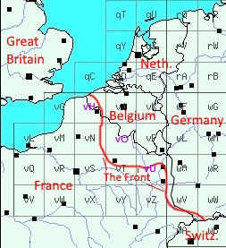
2. Each zone is subdivided into squares of 500 kilometers per side. Each of these is designated by a low case letter, from "a" to "z". The squares for northern France all start with "v"
3. Each of these squares is further subdivided into 25 squares. These are identified by upper case letters, from "A" to "Z" omitting the letter "I". Each of these squares are identified by the combination of two letters, for example, the squares for northern France are 'vH','vO', and vU' indicating a particular square within the larger square "v"

4. Within each of these squares, the map is subdivided further into 36 numbered squares.
5. Within each numbered square locations are identified by the number of kilometers east west and the number of kilometers north south from location (0,0) in the lower left corner of the square.
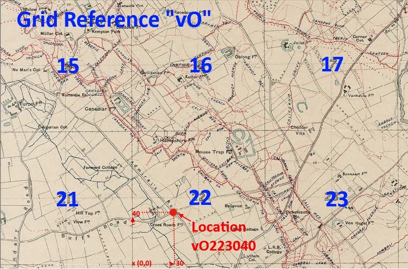
6. As an example, here is a map of squares 15, 16, 17 18, and 21, 22, 23 24, within Grid 'vO'. The red dot where Admiral's Road meets Buffs is in Square 22 at location vO223040.
That means that this location is at 30 on the east-west axis by 40 on the north-south axis, in square #22 of grid 'vO'.

